























by InTrieste
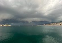
Friuli Venezia Giulia is expected to experience a spell of unsettled weather over the weekend, with heavy rain in eastern areas, possible thunderstorms and a sharp drop in temperatures before more stable conditions return early next week.
Rain is forecast to arrive on Friday evening and continue into the early hours of Saturday, particularly in the eastern part of the region, where precipitation could be locally heavy.
Saturday is expected to begin with variable cloud cover and a temporary break in the rain. A second weather front is forecast to cross the region around midday, bringing scattered showers, possible thunderstorms and snowfall at elevations as low as 1,000 meters in mountainous areas.
Conditions should improve during the afternoon, although strong Bora winds are expected along the coast. In Trieste, gusts could reach 80 kilometers per hour, according to the regional forecast.
Sunday will bring a transition toward more stable weather as high pressure begins to build over the region. However, moisture carried by Atlantic air at higher altitudes could keep skies mostly cloudy, with periods of overcast conditions.
Temperatures will remain cool, with daytime highs around 14 degrees Celsius, significantly lower than those recorded in recent days.
Warmer Weather Expected Next Week
A more sustained improvement is forecast from Monday, as a high-pressure system expands across Europe and settles over Italy, bringing drier air and more stable conditions.
Monday should see partly cloudy skies and chilly morning temperatures, with lows around 5 degrees Celsius in the plains. Afternoon temperatures are expected to recover to approximately 18 degrees.
Clear skies and further warming are forecast for Tuesday and the middle of next week, when temperatures could rise above 20 degrees Celsius, potentially exceeding seasonal averages.
The shift would bring a return to milder conditions after a brief but marked spell of autumn weather over the weekend.